Tasman Sea Pictures, Images and Stock Photos
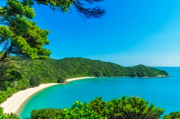
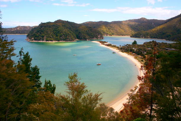
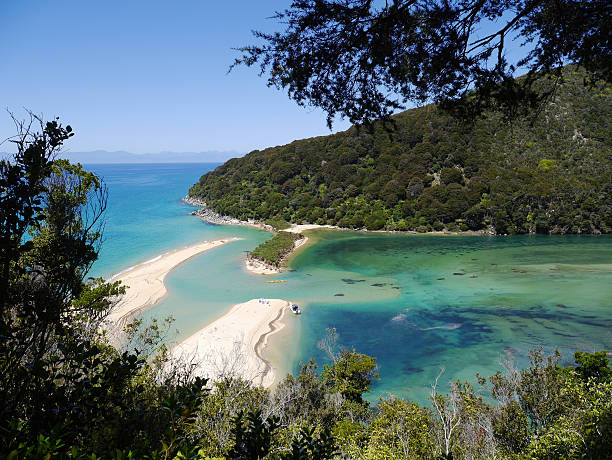
panoramic view of a tropical beach with turquoise water and white sand in abel tasman national park, new zealand
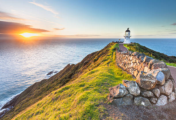
Cape Reinga at Sunset.

Abel Tasman National Park. White sand bay and turquoise sea. New Zealand
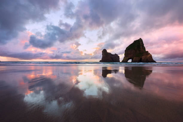
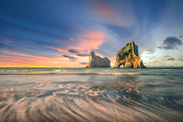
A dramatic and colourful sunset is reflected in the sand at Wharariki Beach on the South Island of New Zealand. The Archway Islands are silhouetted against the sky.
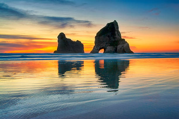
Sunset at Wharariki beach, West coast, South Island, New Zealand.

Puponga, New Zealand.
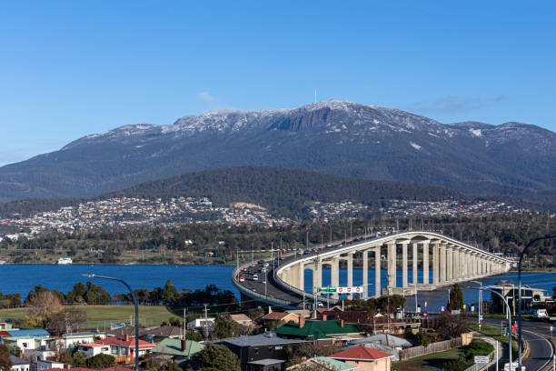
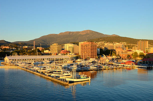
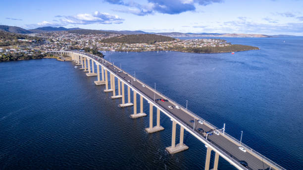
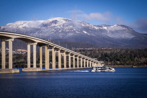
View of Mount Wellington Hobart and the Tasman Bridge, with some trees in the roof houses in the foreground, Hobart, Tasmania, Australia

New Plymouth is major city in Taranaki region, New Zealand
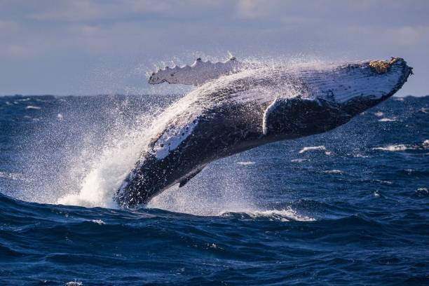
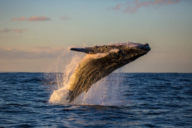
Large humpback whale breaches off Sydney, Austra
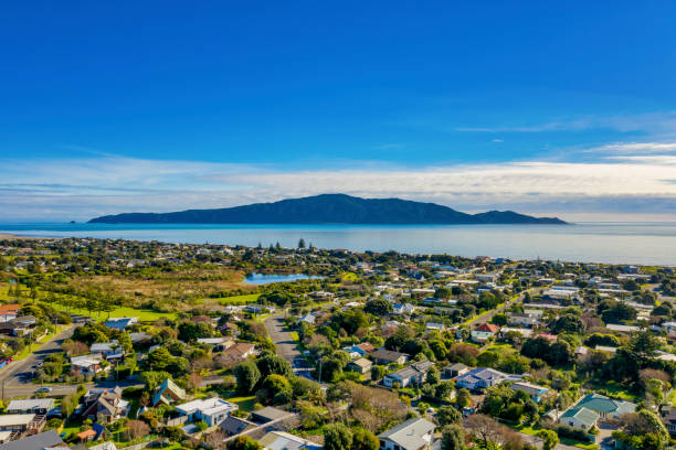
Kapiti Island taken using the Mavic 2 and in the foreground the suburban houses of Waikanae Beach
Kaiteriteri, New Zealand.
A view of Sullivans Harbor in Hobart, Tasmania on a clear day with Mt. Wellington rising in the background. The Broadcast Australia Tower, or NTA, sticks up on Mt. Wellington like a rocket poised for takeoff,
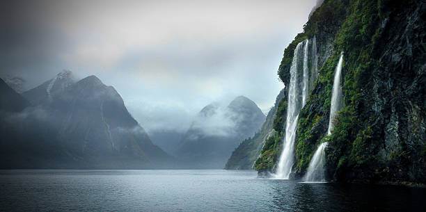
Beautiful waterfalls on a cloudy day in the Sounds

Aerial of Greymouth and the mouth of the Grey River, West Coast, South Island, New Zealand.
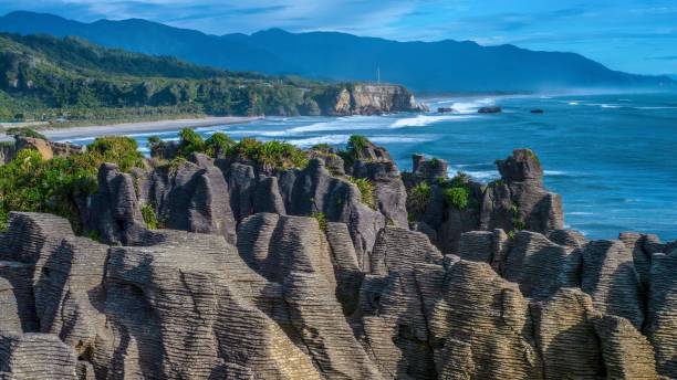
In the foreground is a large set of unusual pinnacle rock formations on land, with grooves eroded into the limestone by water coming through a blowhole, making them look like pancakes. In the background is a beautiful seascape, with a beach, cliff, and low mountain range, while waves from the Tasman Sea break along the shoreline.


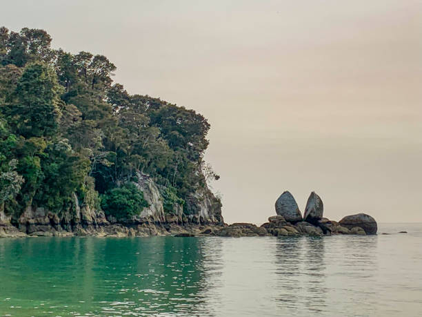
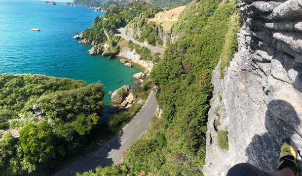
View of Split Apple Rock, Able Tasman National Park, South Island of New Zealand.
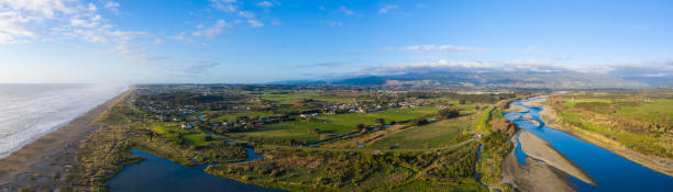
A stitched elevated drone shot taken from Otaki River mouth looking north over the township of Otaki with the Tararua mountain to the east

Kaiteriteri, New Zealand.

New Plymouth, Taranaki region, New Zealand
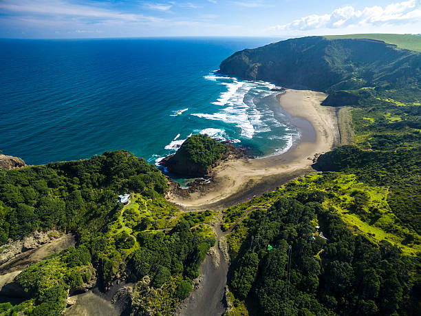
Aerial view of Bethells Beach, Auckland / New Zealand
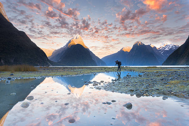
Milford sound New Zealand
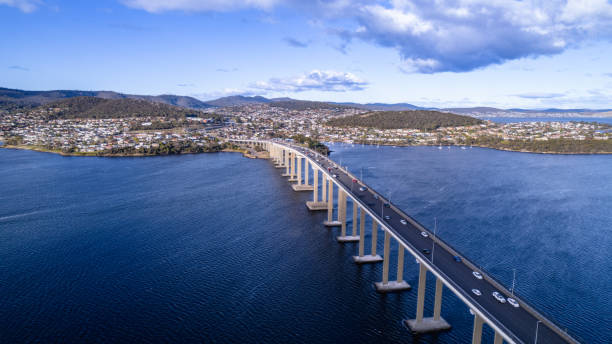
Mt Wellington with snow and Tasman bridge view from Rose Bay near Hobart, Tasmania Australia

Kaiteriteri, New Zealand.


View of Split Apple Rock, Able Tasman National Park, South Island of New Zealand.
National Park New Zealand
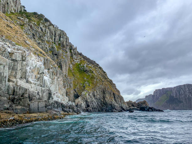
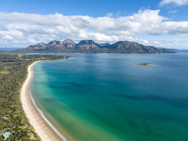
Cape Hauy, Eaglehawk Neck coastal cliff view on Tasman National Park conservation area, Port Arthur, Tasmania, Australia.

View over Puponga bay near Farewell Spit, Golden Bay, New Zealand
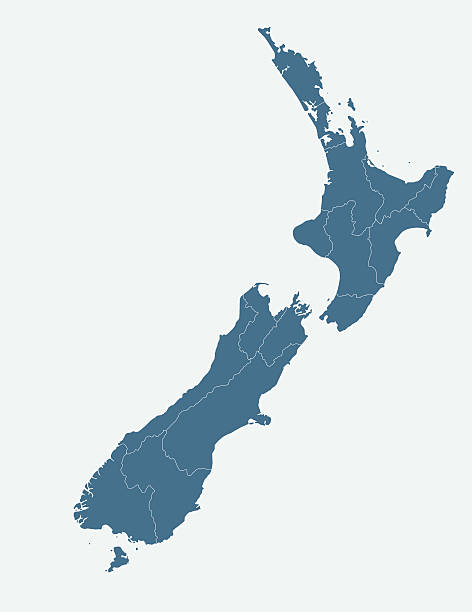
Very detailed New Zeland map - easy to edit.

Winter sunset at Wharariki Beach at the top of New Zealand's South Island. The clouds are turned red by the setting sun. The rocks are the Archway Islands. This beach is a popular tourist destination and is know for it's beautiful reflections of the islands.
Humpback whale breaching shot at sunset off Manly Beach, Sydney, New South Wales, Australia. Taken during whale watching sunset tour

vector illustration of Tasmania map
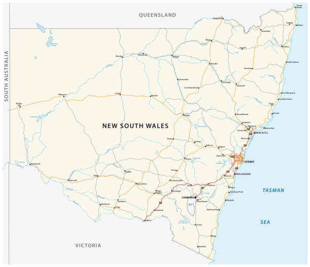
Road vector map of the Australian state New South Wales map
New South Wales, Australia.

Display Of Fresh Salmon Fillets In Fish Market
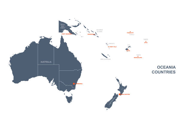
detailed oceania countries map.
The view at Mount Wellington at sunset in Hobart, Tasmania, Australia. Mount Wellington is a popular location to watch sunset and is a short drive from Hobart city centre.
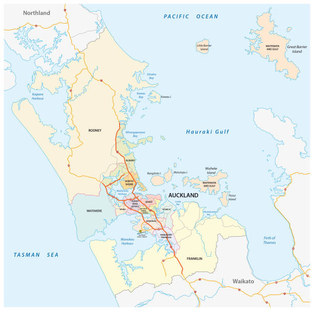
Administrative, political and road map of the New Zealand city Auckland.
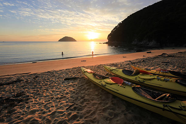
"Sunrise over Abel Tasman National park, New Zealand on a sea kayaking trip."
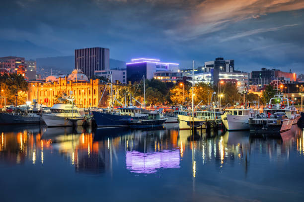
Tasmania Hobart Cityscape Waterfront in Sunset Twilight. Sailboats and Tour Boats anchored in Victoria Dock at the Victoria Dock Waterfront in the Capital City of Hobart. Illuminated Tasmanian Museum and Gallery at the waterfront promenade background (left) under moody twilight skyscape. Victoria Dock, Hobart, Tasmania, Australia
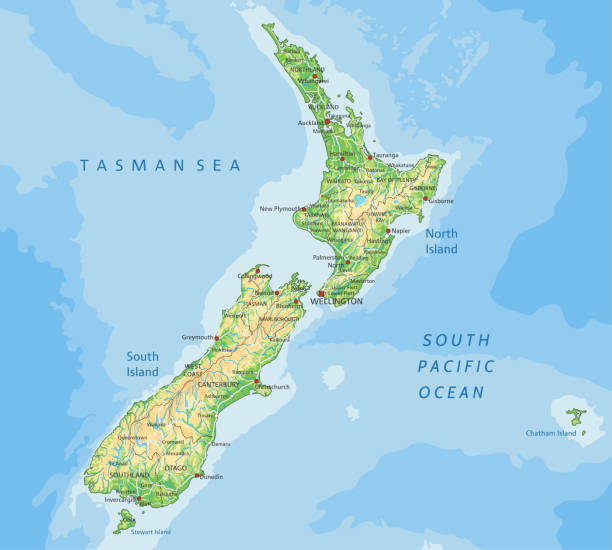
High detailed New Zealand physical map with labeling. Organized vector illustration on seprated layers.

Travel bubble concept - Airplane traveling in bubble representing international travel bubble project to revive tourism and hotel industry among countries that show good control of covid 19 spreading.
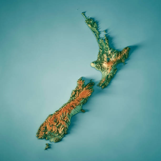
3D Render of a Topographic Map of New Zealand. All source data is in the public domain. Color texture: Made with Natural Earth. http://www.naturalearthdata.com/downloads/10m-raster-data/10m-cross-blend-hypso/ Relief texture and Rivers: SRTM data courtesy of USGS. URL of source images: https://e4ftl01.cr.usgs.gov//MODV6_Dal_D/SRTM/SRTMGL1.003/2000.02.11/ Water texture: SRTM Water Body SWDB: https://dds.cr.usgs.gov/srtm/version2_1/SWBD/

New Zealand Flax in Flower with a Classic Clear New Zealand Spring Sky and Golden Sand Estuary.
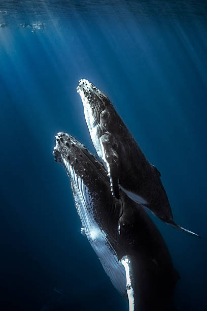
Calf humpback whale with mom.

new zealand road vector map
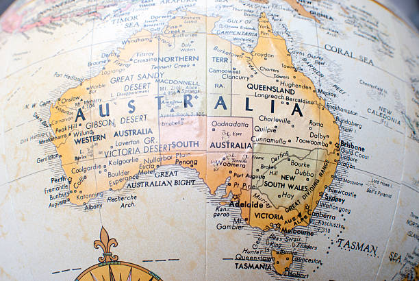
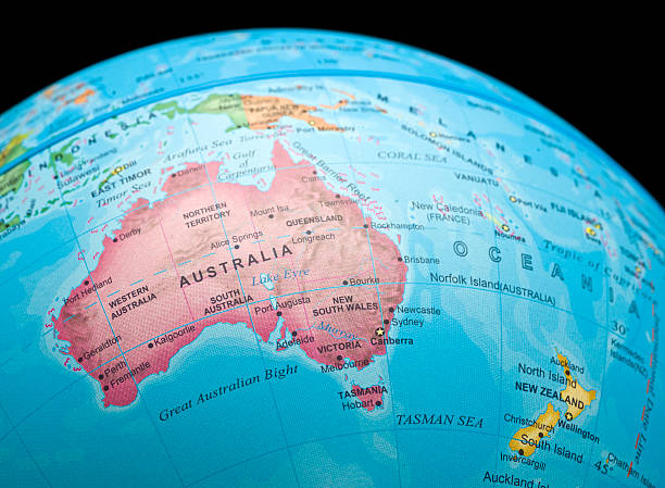
Close up of Australia on a world Atlas
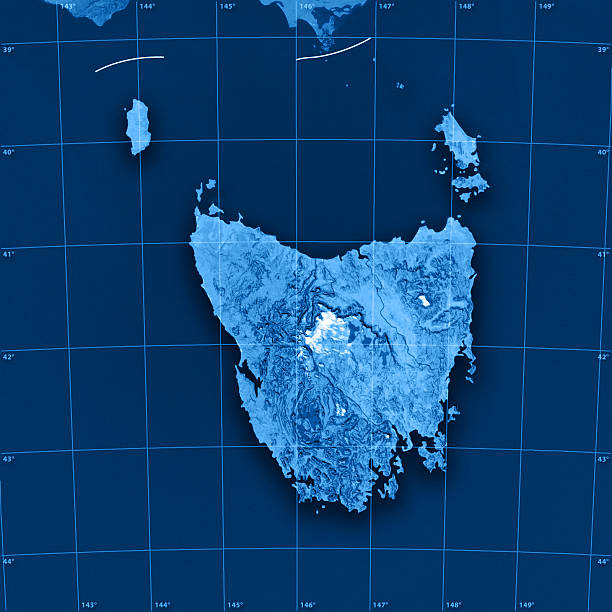
"3D render and image composing: Topographic Map of Tasmania, Australia. Including state borders, rivers and accurate longitude/latitude lines. Very high resolution available! High quality relief structure!Relief texture and satellite images courtesy of NASA. Further data source courtesy of CIA World Data Bank II database.Related images:"
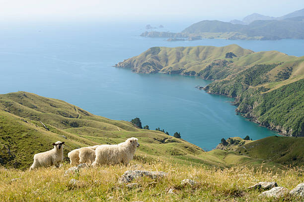
Sheep at the Marlborough Sounds (Okuri Bay), South Island, New Zealand