Armenia Country Pictures, Images and Stock Photos
Browse 10,300+ armenia country stock photos and images available, or start a new search to explore more stock photos and images.
Most popular
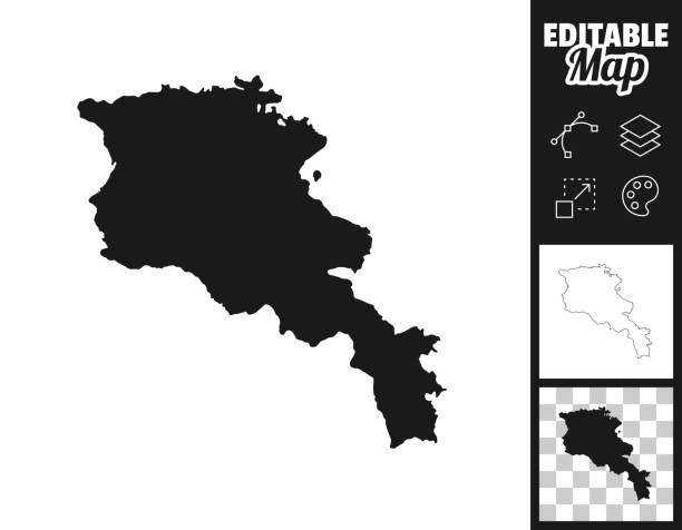
Map of Armenia for your own design. Three maps with editable stroke included in the bundle: - One black map on a white background. - One line map with only a thin black outline in a line art style (you can adjust the stroke weight as you want). - One map on a blank transparent background (for change background or texture). The layers are named to facilitate your customization. Vector Illustration (EPS file, well layered and grouped). Easy to edit, manipulate, resize or colorize. Vector and Jpeg file of different sizes.
Armenia icons set cartoon vector. Tourism architecture. National city
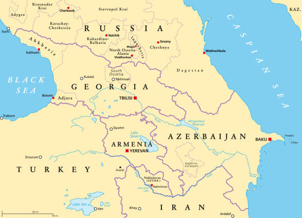
The Caucasus, or Caucasia, political map. A region between the Black Sea and the Caspian Sea, mainly occupied by Armenia, Azerbaijan, Georgia, and parts of Southern Russia, with disputed areas. Vector
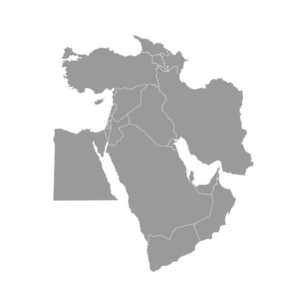
Vector illustration with simplified map of Asian countries. Middle East. States borders of Turkey, Georgia, Armenia, United Arab Emirates, Saudi Arabia, Qatar, Oman, Iran, Israel. Grey silhouette
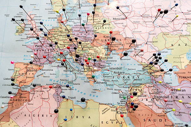
European And North African Map Pinned
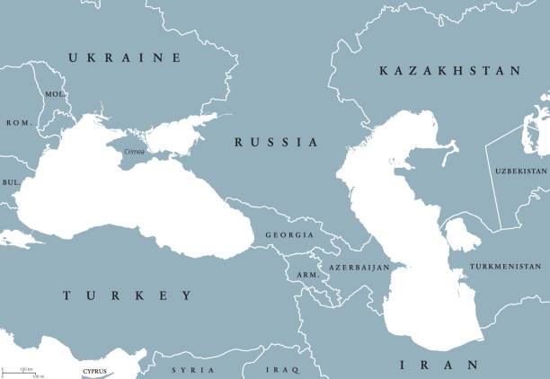
Black Sea and Caspian Sea region political map with countries, borders and English labeling. Bodies of water between Eastern Europe and Western Asia. Gray illustration. Vector.
Armenia Vector Map. Vector Illustration with National Flag Map was found: http://legacy.lib.utexas.edu/maps/commonwealth/armenia_pol_2002.jpg Created in Adobe Illustrator with splines 12-07-2020
The Caucasus, or Caucasia, gray political map. Region between the Black Sea and the Caspian Sea, mainly occupied by Armenia, Azerbaijan, Georgia, and parts of Southern Russia. Map with disputed areas.
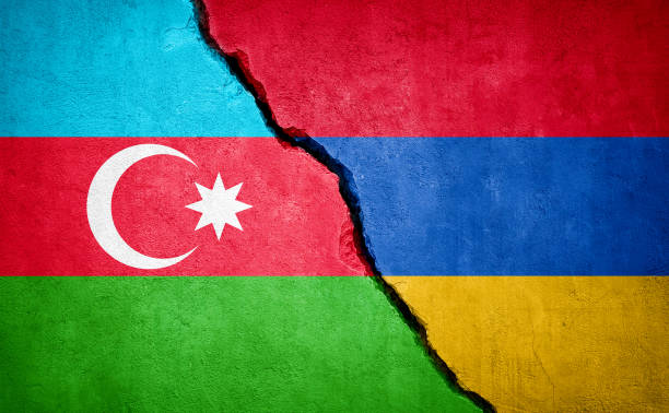
Azerbaijan and Armenia conflict. Country flags on broken wall. Illustration.
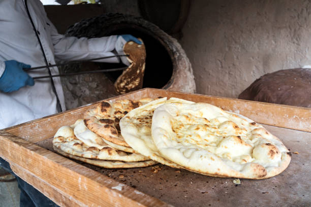
aged man makes traditional bread in old round stone oven in rural village. Large flat freshly baked tortillas lie on the table. Hot bread. Central Asian cuisine.
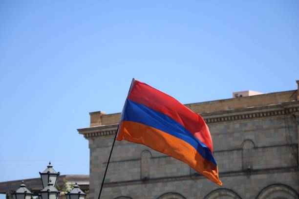
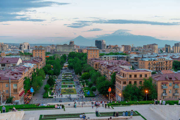
The flag of Armenia waving with the Republic Square building in the background

Armenia-Azerbaijan conflict in Nagorno-Karabakh on outline geographic map.
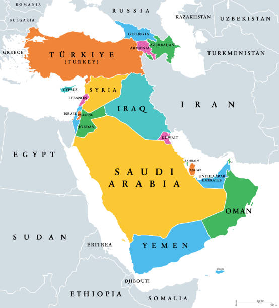
Western Asia, geoscheme and political map. Subregion of Asia, used for statistical purposes, covering geographical regions spanning from Anatolia, Caucasus, Levant, Mesopotamia till Arabian Peninsula.

The flag of the Armenia Caucasus region Flag. Horizontal format. Flag file is in official RGB color space for accurate representation on digital and rgb based print media. Fully editable and scalable vector eps 10 format and high resolution jpg.

Mount Ararat rises above the clouds, dawn light, panoramic view, vector illustration
Armenian round flag icon graphics design. Perfect for backgrounds, backdrop, sticker, icon, sign, symbol, badge, label etc.
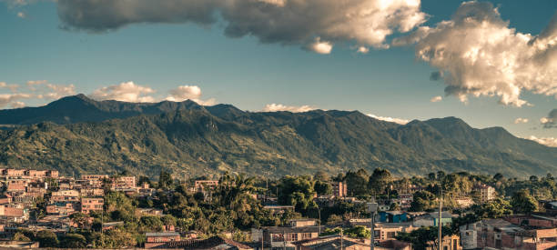
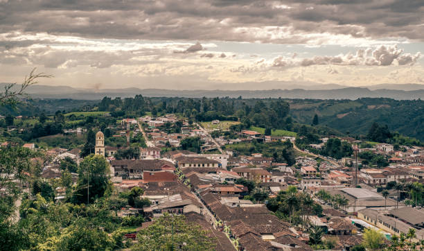
The mountain ridge at the East of the town of Armenia, Quindio, Colombia
Aerial view of the town of Salento, Quindío, Colombia. Coffee production area.
Dogubayazıt, Turkey, Middle East - 06/30/2019: aerial view of the breathtaking landscape on the dirt and winding road on the plateau around Mount Ararat, Agri Dagi, with rocky peaks, hills, grassland and flowers near the Ishak Pasha Palace
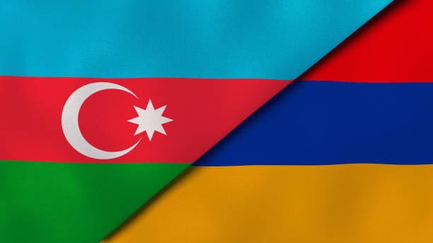
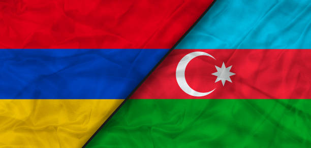
Two state flags of Azerbaijan and Armenia. High - quality business background. 3d illustration
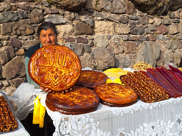
"Gerhard, Armenia - November 26, 2010: Woman is selling traditional Armenia bread on improvised stands on parking place in front of Gerhard monastery. In background is wall from the monastery and is on white traditional weaving lace tablecloth."
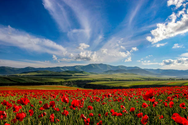
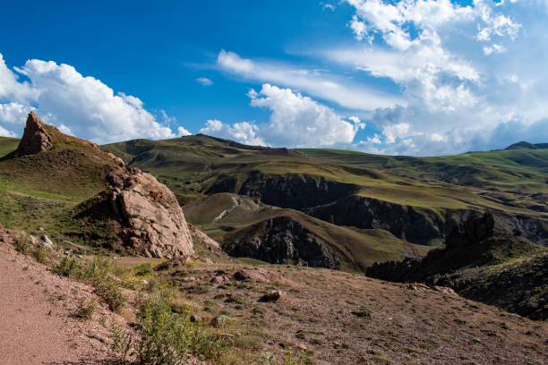
Beautiful field of flowering poppies on a background of mountains. Beautiful Nature Of Armenia, Province Lori.
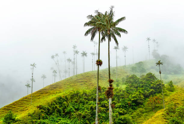
Wax Palm Trees (Ceroxylon quindiuense), the highest in the world, in the mist of the Cocora Valley near Salento and Armenia, Colombia. This type of tree also appears in Ecuador and Northern Peru.

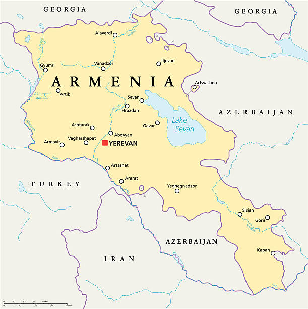
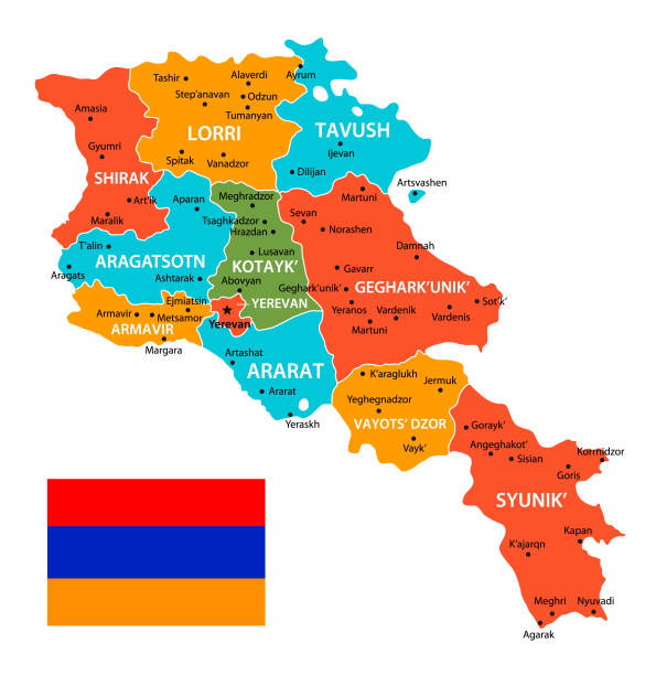
Armenia Political Map with capital Yerevan, national borders, important cities, rivers and lakes. English labeling and scaling. Illustration.
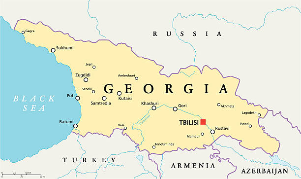
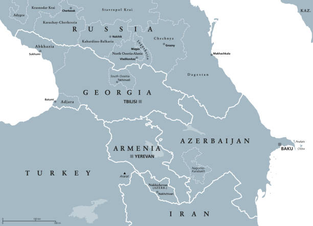
Georgia Political Map with capital Tbilisi, with national borders, important cities, rivers and lakes. English labeling and scaling. Illustration.

Armenia and United States flags together realtions textile cloth fabric texture
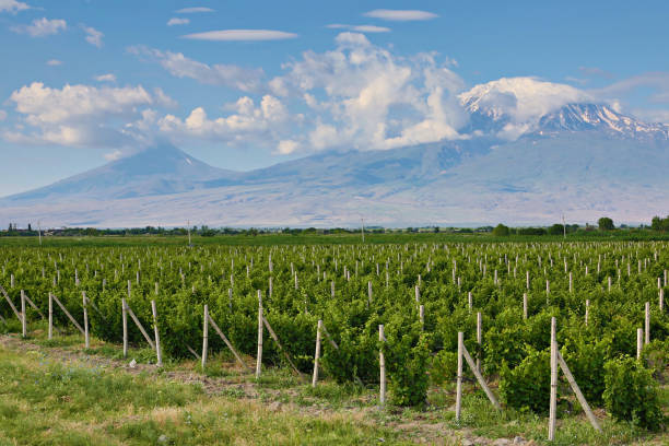
Vineyards in Armenia

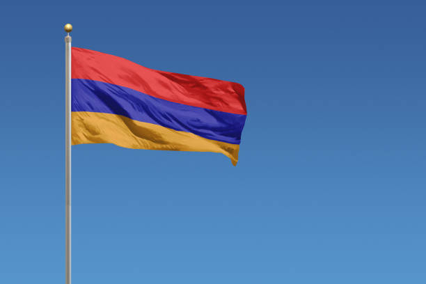
Armenia flag waving in the blue sky in the wind
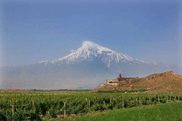
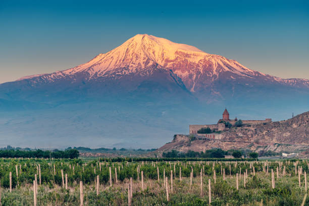
A historical view of the mountain Ararat from Armenia, monastery Khor Virap and vineyards
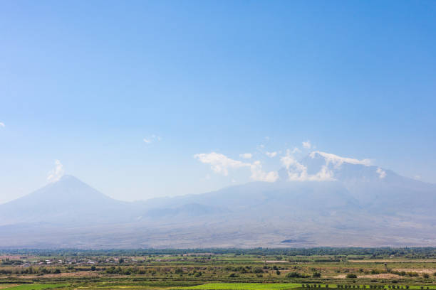
Landscape of Armenia with the biblical Mount Ararat
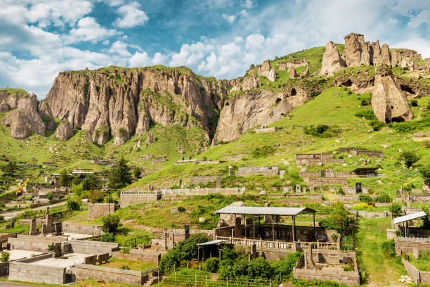
28 May 2021, Goris, Armenia: Old city cemetary and ancient cave dwellings in a town carved out of soft sandy rocks

The Caucasus, Caucasia, colored political map. Region between the Black Sea and the Caspian Sea, mainly occupied by Armenia, Azerbaijan, Georgia, and parts of Southern Russia. Map with disputed areas.
Armenia, set of colorful design elements and icons.
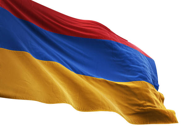
Armenia flag close-up waving isolated white background realistic 3d illustration
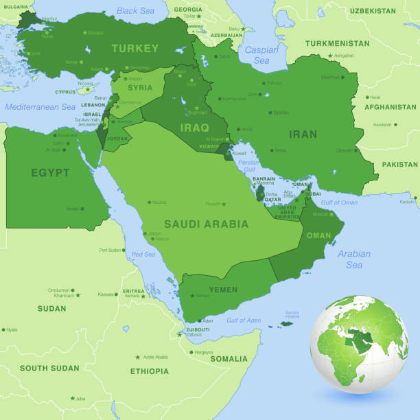
High detail map of the Middle East Zone, with a 3D Globe centered on Middle East.

Flag of Armenia.
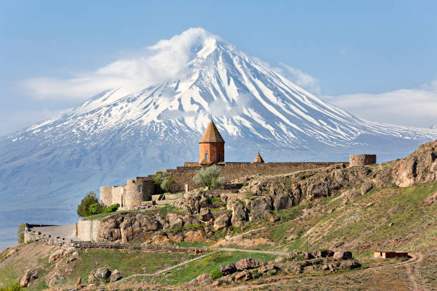
Khor Virap, Armenian orthodox religious complex with Mount Ararat in the background, in Artashat, Armenia.
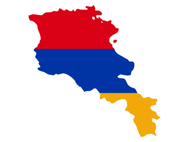
vector illustration of Map of Armenia with national flag
The National flag of Armenia
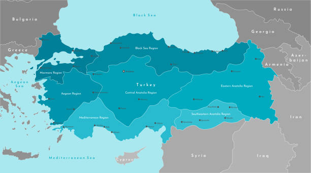
Vector modern illustration. Simplified geographical map of Turkey and nearest states (Syria, Greece, Bulgaria, Iran and etc.) Blue background of Black and Mediterranean Sea. Turkish cities and regions

Close-up of American flag on the left side, blue and white colored space for text on the right side of the image. Holiday, american celebration and sales banner.
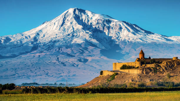
Majestic snowcapped Mt. Ararat and monastery Khor Virap, Armenia

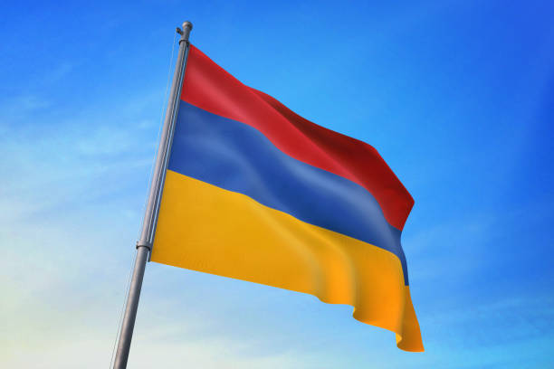
Armenia national flag
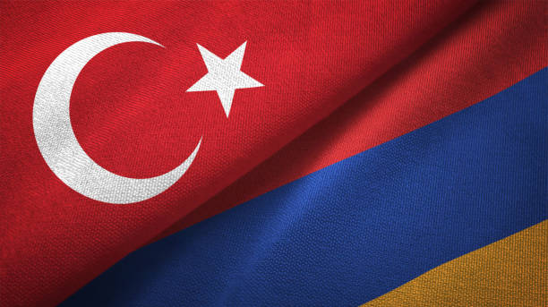
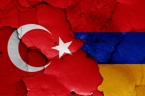
Armenia and Turkey flag together realtions textile cloth fabric texture
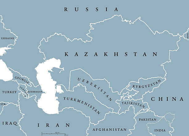
Caucasus and Central Asia countries political map with national borders. English labeling. Illustration.
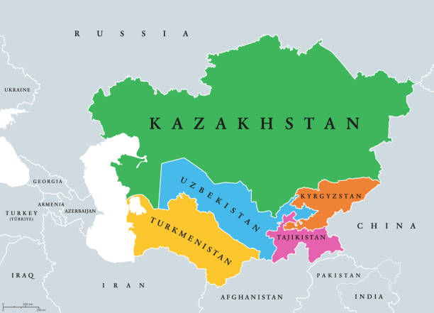
Central Asia, or Middle Asia, colored political map. Region of Asia from Caspian Sea to western China, and from Russia to Afghanistan. Kazakhstan, Kyrgyzstan, Tajikistan, Turkmenistan, and Uzbekistan.
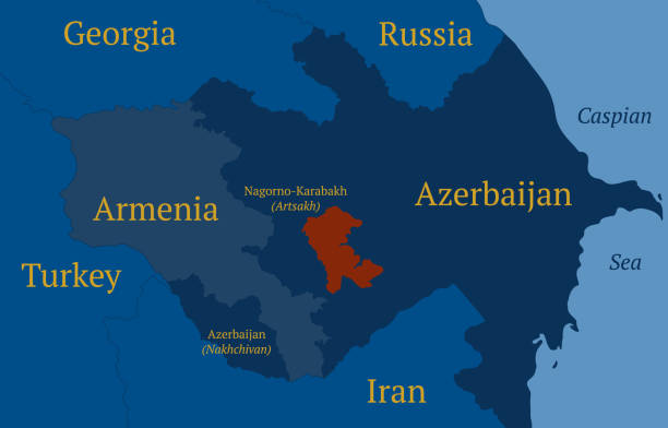
Territory map of Nagorno-Karabakh under the 2020 peace deal. Artsakh or the Republic of Nagorno-Karabakh. Detailed outline geographic map. Template for design and infographics.
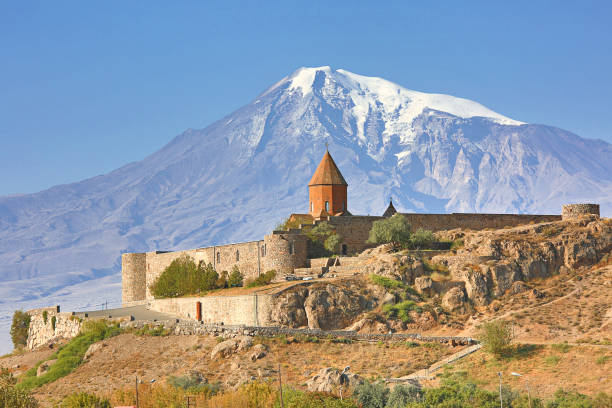
Khor Virap Monastery in Armenia with the Mount Ararat in the background in Armenia

Illustration image of the national flag of Armenia.

Illustration of a Political Map of USSR with Names