Anhui Province Pictures, Images and Stock Photos
Browse 10,600+ anhui province stock photos and images available, or search for huangshan to find more great stock photos and pictures.
Most popular
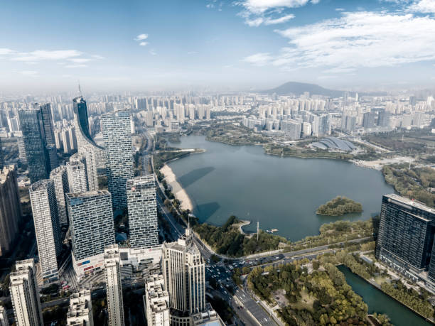
Aerial view of highway junction with little traffic anhui
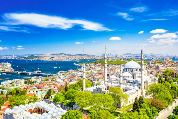
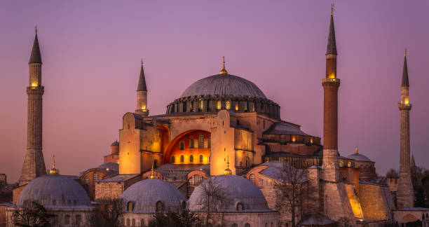
Aerial drone view of the Suleymaniye Mosque, huge Ottoman imperial mosque in Istanbul, Turkey
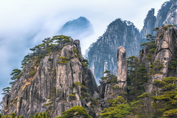
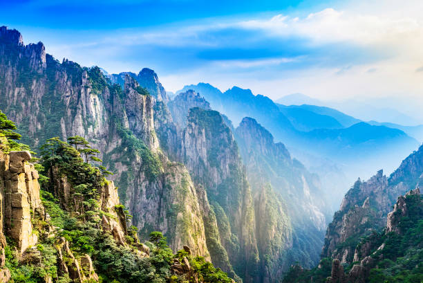
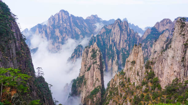
view from Refreshing terrace in Huangshan mountain (Yellow mountain), known as the loveliest mountain of China, World Natural and Cultural Heritage site by UNESCO, Anhui, China.
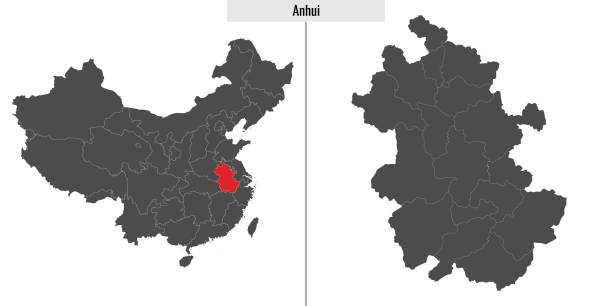
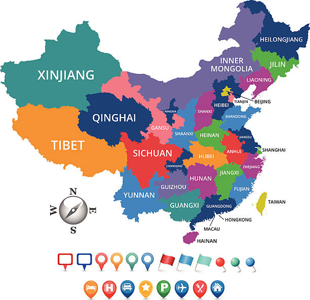
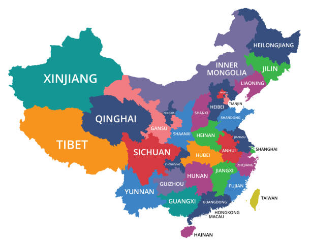
map of Anhui province of China and location on Chinese map
Mountain Huang is a most famous mountain in China.
Aerial view of huangshan mountain landscape at morning, China.


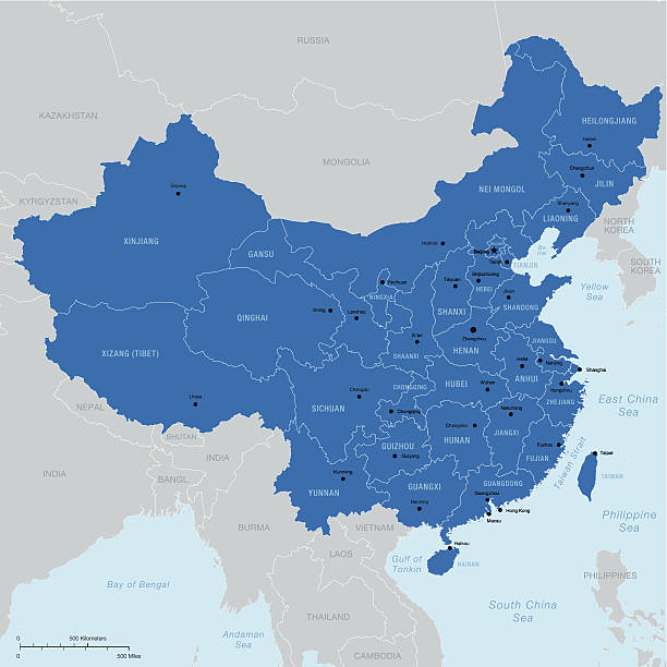
Highly detailed vector map of China with regions, capital and big cities.
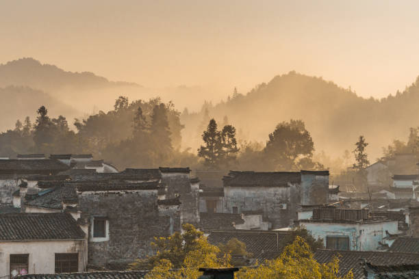
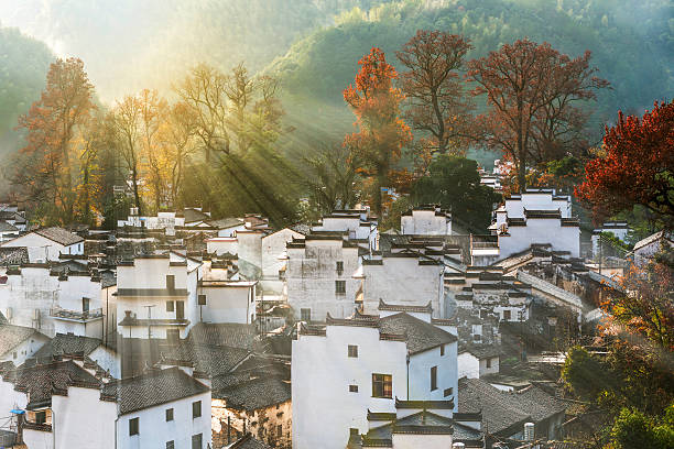
Sunrise view of the Chinese historic architecture in Xidi village, in Anhui province, China.
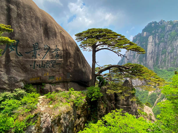
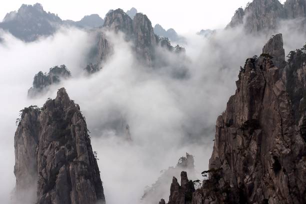
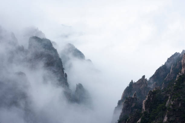
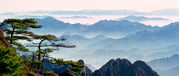
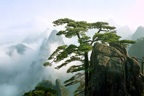
Huangshan, Anhui, China- May 23, 2020: The Yellow Mountains is one of the most famous and beautiful mountainous areas in China. It was listed as a World Heritage Site by UNESCO in 1990. Its spectacular natural scenery includes oddly-shaped pines and rocks, and mystical seas of cloud. It is one of the most visited scenic destinations in China. Here is the Oddly-Shaped Pine of the Yellow Mountains Greeting-guests Pine looks like a host flings arms out to welcome guest.

Ramadan Pide - Turkish popular bread for Ramadan month on a gray background. Copy space and top view.
EPS 10 and JPEG

Sambali, traditional Turkish dessert from Izmir. Street sweet food.

Sushi chopsticks and soy sauce. Realistic Japanese restaurant tableware. Wooden sticks. White plate. Porcelain bowl. Utensil top view. Chinese food serving. Empty saucer. Vector isolated dishware set
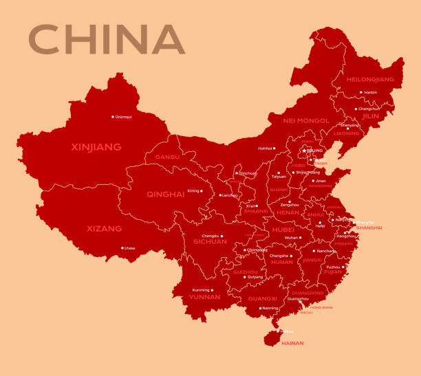
Map of China. Chinese administrative districts and divisions.
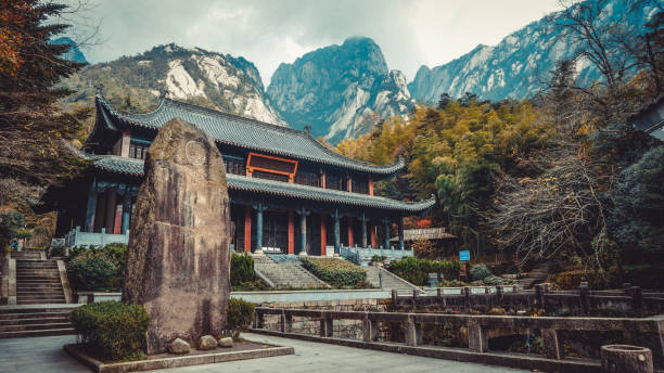
Chinese building near the Huangshan National Park. China
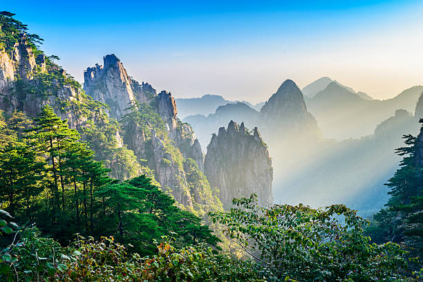
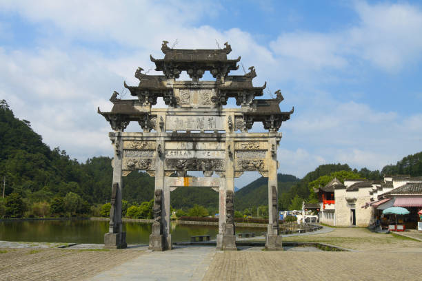
Huangshan (Yellow Mountains), a mountain range in southern Anhui province in eastern China. It is a UNESCO World Heritage Site, and one of China's major tourist destinations.
Traveller compass of different design. Single one line drawing equipment for exploration and navigation. Continuous line draw touristic object locating direction. Cartography concept vector
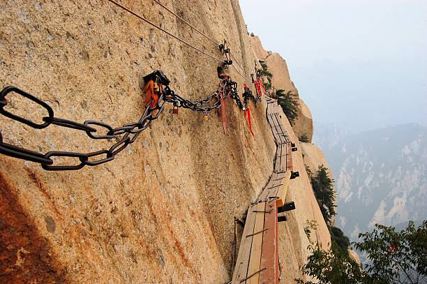
Dangerous walkway via ferrataat top of holy Mount Hua Shan in Shaanxi province near Xi'an, China
China Huangshan winter, snowy weather
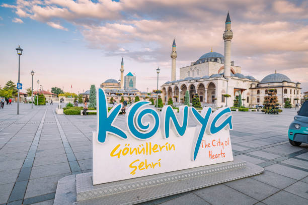
13 September 2022, Konya, Turkiye: Main square in Konya city with famous Mosque and Mevlana museum in the background

A young female traveler with a backpack on her back walks towards the Fatih Mosque in Istanbul.
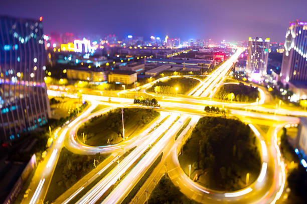
Aerial view of highway junction with little traffic anhui
Red Compass logo design template. Adventure or travel sign icon. Vector illustration on white background.

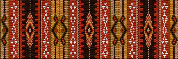
A traditional ornament of the peoples and countries of Asia, in which saturated colors attract luck and wealth. Women's woven carpets with ornament embroidered on fabrics for dresses. Embroidery patterns.
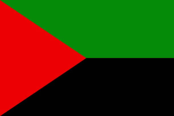
Simple flag of Martinique. Correct size, proportion, colors
Famous Hagia Sophia Mosque or Ayasofya Camii illuminated during sunset time in Sultanahmet Park, Istanbul, Turkey.
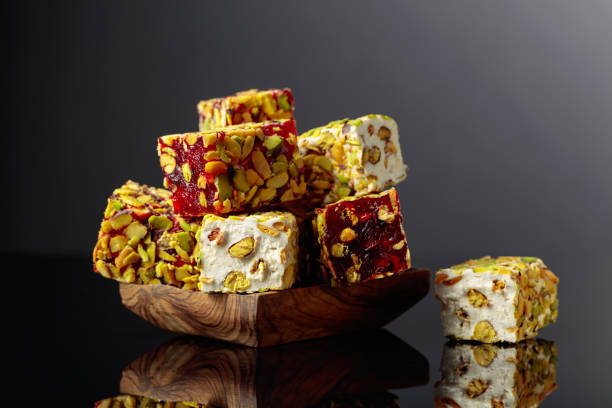
Traditional Turkish delight in a wooden dish on a black reflective background.
Huangshan (Yellow Mountains), a mountain range in southern Anhui province in eastern China. It is a UNESCO World Heritage Site, and one of China's major tourist destinations.

Inspired indian male office employee or student carrying laptop isolated on plain yellow color, handsome arab man full of new ideas looking aside thoughtfully, start-up owner
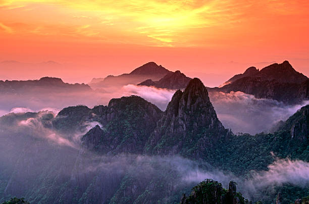
a spectacular warm, hazy sunrise over the North Sea area of Mount Huangshan. Cloud swirls drifting around "Ascending Peak" have picked up the colours of the sunrise whilst the front of the mountain and the green Huangshan Pines in particular, have been lit by light reflecting off the low cloud (behind the camera). Fujichrome Velvia 50 transparency scanned on Imacon 949.
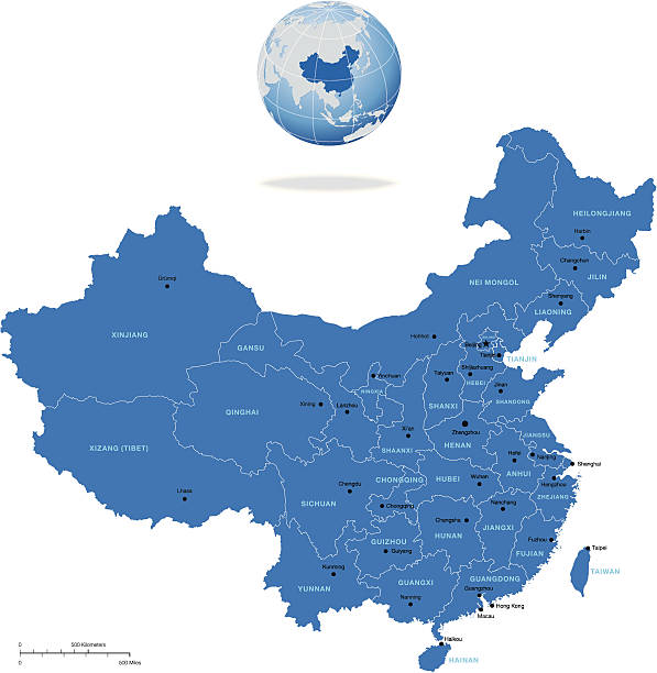
Highly detailed vector map of China with regions, capital and big cities

E-learning. Multiracial Indian man in turban using laptop for watching online courses, webinars, takes notes sitting in the park in campus, male student preparing exams, taking educational classes
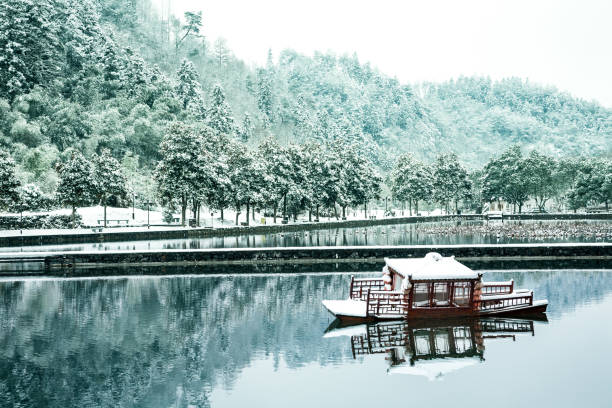
A pond and a small boat in the ancient village of Xidi in the Anhui province of China in winter under snow
Turkey country icons set. Flat set of turkey country vector icons isolated on white background
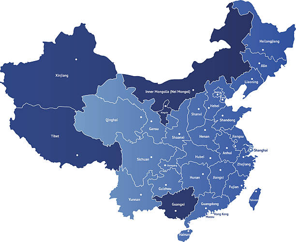
Detailed vector map of China with the names of the provinces. Each of provinces you can separate and use as individal map.

Great for any print or web projects :biggrin:
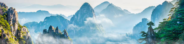
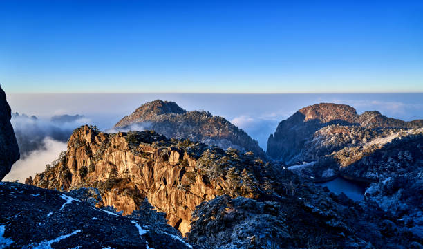
Landscape of Mount Huangshan (Yellow Mountains). UNESCO World Heritage Site. Located in Huangshan, Anhui, China.

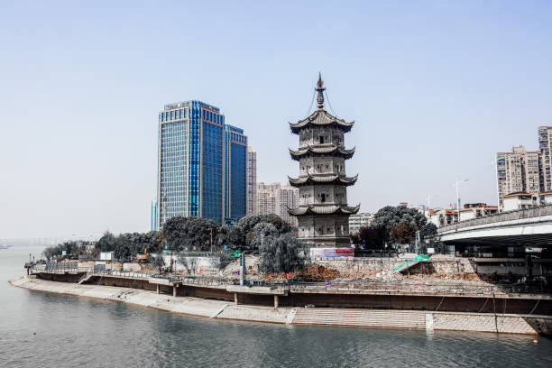
Arch bridge in Lin'an district of Zhejiang province, China

Detailed 3D vector map of China. The map was divided into separate layers. Included Zip with AI file with the names of the provinces.
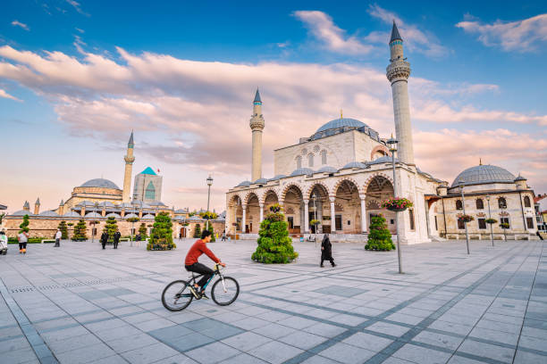
13 September 2022, Konya, Turkiye: Main square in Konya city with famous Mosque and Mevlana museum in the background

China country map outline vector illustration with scales of miles and kilometers, borders of states or provinces and their names, and capital location and name, Beijing


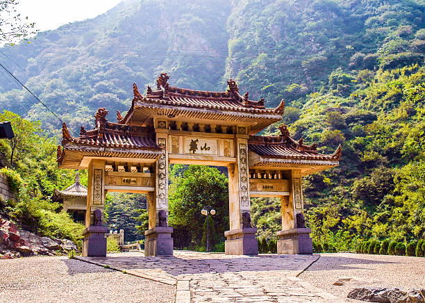
Huashan(Mountain Huashan)-memorial gateway of main gate. Huashan Mountain is one of famous Mountains in China. It is located in SHanxi province CHina, 120 kilometers away from Xian.
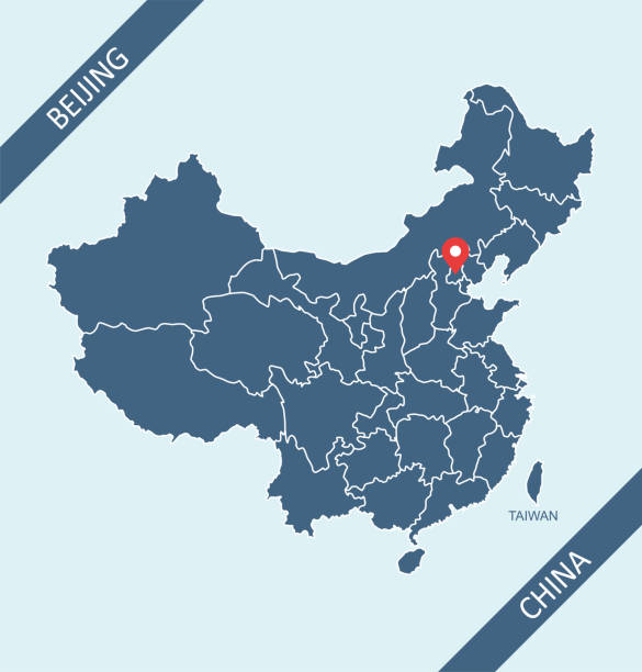
Highly detailed downloadable and printable map of China with its capital location, Beijing, for web banner, mobile, smartphone, iPhone, iPad applications and educational use. The map is accurately prepared by a map expert.

3D Render of a Topographic Map of the East China region. All source data is in the public domain. Color texture: Made with Natural Earth. http://www.naturalearthdata.com/downloads/10m-raster-data/10m-cross-blend-hypso/ Relief texture: GMTED2010 data courtesy of USGS. URL of source image: https://topotools.cr.usgs.gov/gmted_viewer/viewer.htm Water texture: SRTM Water Body SWDB: https://dds.cr.usgs.gov/srtm/version2_1/SWBD/ Boundaries Level 0: Humanitarian Information Unit HIU, U.S. Department of State (database: LSIB) http://geonode.state.gov/layers/geonode%3ALSIB7a_Gen Boundaries Level 1: Made with Natural Earth. https://www.naturalearthdata.com/downloads/10m-cultural-vectors/
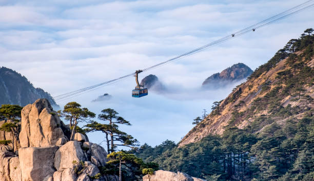
Scenic view of Huangshan yellow mountain cliffs in China from lift cable car and a lot of the mist in the winter season, Huangahan national park is one of the Unesco world heritage site.